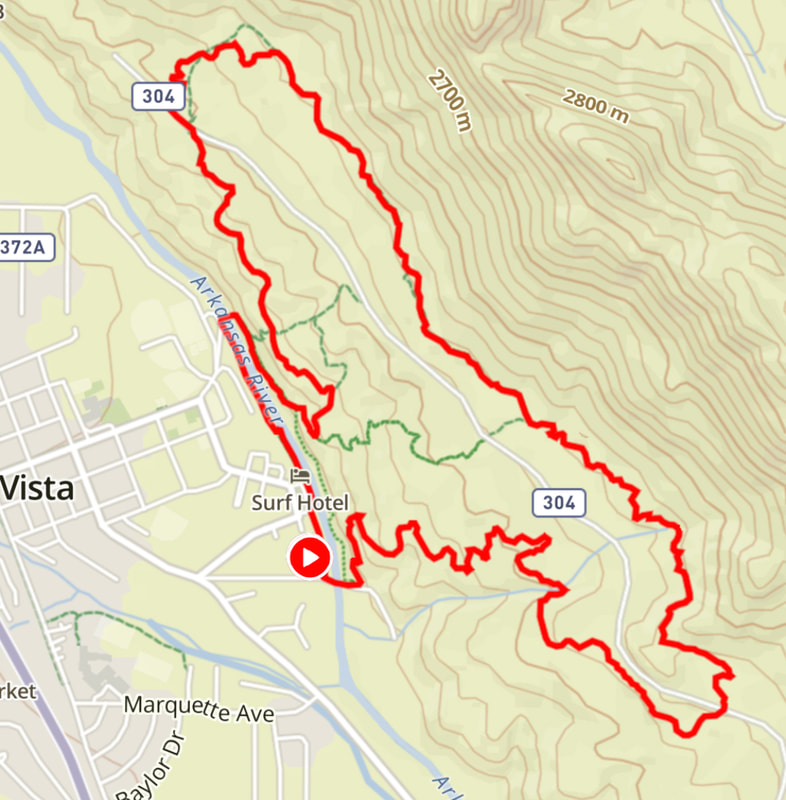
Halloween HOwler 10k Course Map
Course Description
After leaving the starting line, runners will take a sharp left onto the River Trail, running along the Arkansas River for half a mile. Runners will then cross the bridge & run along the east side of the river to the the junction with Whipple Trail. From Whipple Trail runners will merge onto North Trail, taking North Trail to CR 304. After a short stint on CR 304, runners will reach the first water stop at the bottom of Broken Boyfriend North Trail. Runners will take North Broken Boyfriend, continuing onto South Broken Boyfriend until its end back on CR 304 & the aid station (water & food). Runners will cross CR 304, continuing down Camp Elevation road until it reaches Elevation Trail. Runners will take Elevation back to the finish line.
Total Distance: 6.3 miles
Elevation Gain: 700 ft.
Total Distance: 6.3 miles
Elevation Gain: 700 ft.

